Heading west towards home …

Today was a big travel day with 550kms from Orbost through to Bendigo. It wouldn’t be too bad except that there was only one route to get there and that involved skirting through Melbourne and its traffic.

The Princes Highway was good doing until I hit Narre Warren and the traffic started to build up and slow down. Roadworks didn’t help much. It took a while to get round to the Metropolitan Ring Road and just as I reached the Calder Highway exit the traffic stopped. It was OK though as I was headed to the Calder Highway.

It was certainly different when travelling through Morwell. Last time I was here you couldn’t see for smoke. I was here fighting the coal mine fire in February 2014 – it doesn’t seem that long ago. The fire went for a month and cost somewhere around $1 million a day to fight, with helicopters, ground crews and lots of different fire appliances from all around Australia. Today, the power station is closed and the only activity in the pit seemed to be remediation work. Oh and the air was clear.

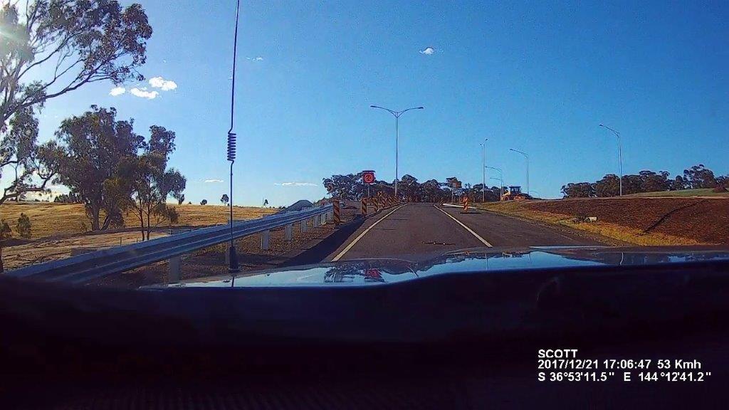
There was one little “oh wow” moment when I took the Alternative Calder Highway exit and what looked to be a stick in the middle of the road was a 1.5m snake. I tried to miss it and didn’t see it come out the back. Hopefully he is not coiled up somewhere under the car or van.

Onward to Mildura tomorrow.

Can’t go any further East …

Well the rain did make it here with some heavy downpours through the night and continuing through the morning. This rain didn’t slow me up much as I had a drive through the forest to the north to grab a cache.

It was a 45km drive on windy, hilly, thick forested road for a single cache that gave me a geocache find on Map 23 for the Victoria Country Road Atlas Challenge. It rained all the way there, rained while I was signing the log in the geocache and it rained all the way back.

After doing some restocking and having lunch, it was time to head east to grab the last 2 maps for the Victoria Country Road Atlas Challenge, Map 24 and 34. This would also take me to Mallacoota which is the furthest east you can get in Victoria without serious bushwalking. The rain had moved on, I guess onto New Zealand.

Mallacoota must have one of the biggest foreshore caravan parks in Australia. It seemed to go on forever and was starting to fill up. It has somewhere around 600 sites with around half with power. Although the sites looked small in places – hopefully they were tent sites.

After grabbing a few caches at the beach lookouts along the coast, it was time to head back to the van at Orbost. It was a straight drive back as I had grabbed all the caches on the way here. Just out of Cann River, there was a slight delay with a learner motorcyclist not making it around a corner. Luckily he was wearing full leathers and seemed to be moving OK. The ambulance didn’t seem to be in a hurry to get to him when it passed me.

The rain started again when I arrived back at Orbost but it was just showers that came and went.

Tomorrow it is time for the journey home via Bendigo.

Time to go Underground …

You could have sworn we were in Darwin today and not south-eastern Victoria with the temperatures in the mid to high 30’s and humidity around 60%. It didn’t take much walking to work up a sweat. Lucky Jenny is not here as she would be one unhappy camper.

So what to do in these conditions, go underground of course. I headed to Buchan Caves which is between Bairnsdale and Orbost. Even though the humidity was similar the temperature was 17C for the couple of hours I was underground in the Royal Cave and Fairy Cave. But did it hit you when you got out.

As far as caves go, these were impressive for their features with good stalagmites, stalactites, flowstones, shawls and columns. They even had some helictites that defied reason in their direction of travel.

One thing that did make it unique for tourist caves was the amount of squeezing and stooping through manmade tunnels and tunnels made of chicken wire. This allowed you to be up close and personal with the features without being able to touch them. I would recommend doing these caves provided you are not claustrophobic.

Rather than drag the van around for a couple of days, camp is now set up at the Orbost Caravan Park on the banks of the Snowy River. The weather hadn’t abated with mid 30’s still at 6:00pm but a change was to come around 9:00pm.

On the radar you could see it sweep across Victoria dropping heavy rain and large hail stones. The winds hit here first bringing with it dust. Eventually there was rain but the heavy stuff seems to have missed us for now.

Update on the geocaching: I managed another 3 maps for the Victoria Country Road Atlas Challenge and another 1 shire for the Victorian LGA Polygon Challenge. Only 3 more maps left and still plenty of shires.

Tomorrow I will be heading to the far eastern Victorian border (well as close as I can get).

What about the humidity …

The first thing that hit you today was the humidity. It would be because of the coastal influence and with a bit of warmth and temperatures of 28C today, it didn’t take long to work up a sweat on my little walks.

Today’s travels took me through Koonwarra and Foster which were undulating, and at times steep hills, eventually giving way to coastal flats through Toora, Welshpool, Alberton, Yarram and finally to Sale.

I stopped off at a free camp by the Franklin River but even though my hearing is not the best at times, the noise coming from the cicadas was deafening. Not sure how anyone can get any sleep here. No a problem for me as I am camped at Stratford on the Avon River Tourist Park. It is all quiet here.

There was a large amount of roadworks along the way but the traffic management was not always well executed with lines up to 2 kilometres at the Stratford Bridge.

After setting up around 400pm, I spent the rest of the afternoon grabbing the caches around Stratford. I managed another 2 maps for the Victoria Country Road Atlas Challenge and another 2 shires for the Victorian LGA Polygon Challenge.

Tomorrow it is onto Orbost.

Time for a cruise …

Well the “grey nomad” trend didn’t last long. After waking up at 700am, I promptly looked at my watch and went back to sleep. Needless to say, the Taj was finally on the road just after 1000am.

I farewelled the volcano’s and headed down to Geelong via a roundabout route to take in another couple of council areas for the Victorian LGA Polygon Challenge.

At one of the stops, I noticed the left indicator wasn’t working on the Taj even though my indicators were on. Previously it was just a loose connection but when I went to push the plug in, I almost burnt my hand. A couple of the lugs had melted through the plug. There must have been some serious load on it.

The first order of business in Geelong was to find a new plug. No luck in Bunnings so across the road to Super Cheap Auto which had plenty of 7-pin flat plugs but no 12-pin flat plugs. Third time lucky at Repco but a whopping price of $49. Oh well, I need it.

There was now a choice to make. Choice number one was a 230 km drive through Melbourne traffic on a Sunday afternoon or choice number 2 was take the Queenscliff-Sorrento ferry which was 180 km drive with a sit back on a ferry for 45 minutes. The only choice was the second option. Best $137 I have spent.

The ferry is a roll on – roll off. At Queenscliff, I drove in through the bow and at Sorrento, I drove off through the bow. The trip was smooth with a little wind but it was relaxing up on the top deck taking in the sun. You couldn’t even see Melbourne in the distance.

There was a bit of traffic on the M1 but I was only on it for 25 kms before heading east and south to Inverloch. Even had the opportunity to “blow in the bag” at Tooradin at a police random breath test station but of course came up “zero”.

Made a couple more stops for geocaches, one at the Lang Lang Holden Proving Ground. I wonder how much use that will get now that Holden have ceased manufacturing in Australia.

Digs for the night is the BIG4 Inverloch Holiday Park. A nice park and it is very busy with a lot of kids running around but they have put me in a quiet corner.

Tomorrow I will continue east along the coast.

Volcanos as far as the eyes can see …

The inner “grey nomad” must be coming through as I had the van packed up and was on the road by 830am. 🙂

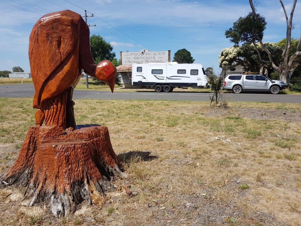
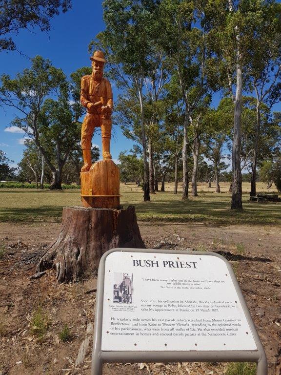
First stop today was Dartmoor in Victoria. This must be the home of tree carvings with an “Avenue of Honour” with chainsaw carvings depicting service men and women. Down the street at the playground there are Australian animals and Nursery Rhymes. A lot of work has gone into them and worth a visit. Down by the river is the Fort O’Hare free camp and there was one group that had “circled the wagons” with a campfire in the middle. Very apt.

It was then down to Warrnambool for a quick visit as I need to find a geocache as part of the Victorian LGA Polygon Challenge. Also made a stop at Bunnings to pick up a short extension cord. It was needed to go from the new inverter to the microwave to warm up my lunch when there is no power available.

Heading northeast now and all around dormant / extinct volcanos were starting to pop up. This area must have been amazing to see back in the day. The last one active was around 8000 years ago which not so long ago in geological terms. I wonder how dormant / extinct they really are.

The caravan park tonight is again on the rim of a volcano. I am starting to see a pattern here. I am staying at the Lakes & Craters Holiday Park which straddles Lake Gnotuk and Lake Bullen Merri which are both volcano craters full of water.

After setting up the van, I spent the afternoon touring the area, grabbing some geocaches as well as climbing some volcanoes.

Headed to Melbourne tomorrow.

Can’t get much more South than here …

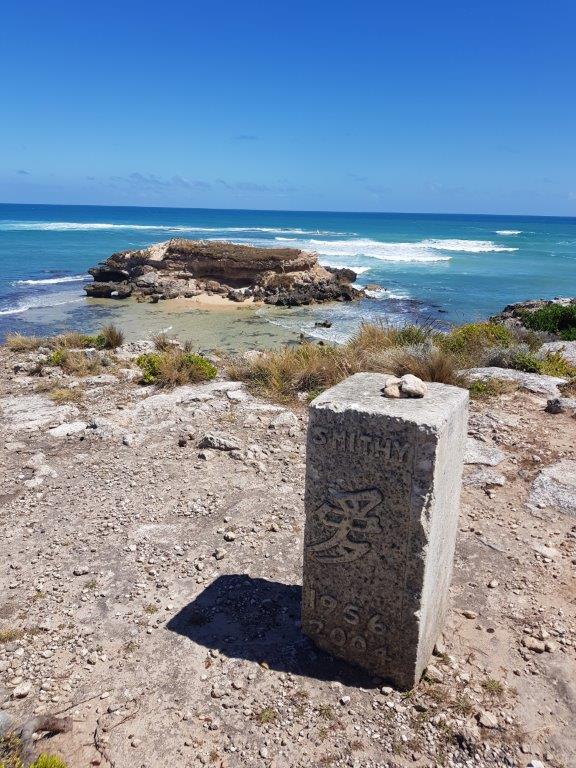
A relaxing morning before heading south to Port MacDonnell and South Australia’s most southern point. Along the way, I made a stop at Mount Schank, another extinct volcano in the South East area. There are 3 geocaches here but I only grabbed one this time through.

It was fairly quiet at Port MacDonnell with a few boats coming in and out of the harbour area. I guess it gets a bit busier on the weekends.

Most of the afternoon was spent checking out the points of interest along the coast. This coast was fairly treacherous in the 1800’s with at least 30 ship wrecks. It is on its second lighthouse at Cape Northumberland.

There was even a fairy penguin colony with no penguins. They had some issues with dogs and foxes decimating the population and there haven’t been any penguins there for a few years.

Adam Lindsay Gordon was a famous Australian poet and horseman who called Port MacDonnell home. His home is now a museum.

I tried to get to the lighthouse and the road on the map ended up being someone’s driveway so you could only get about 200 metres from it.

Heading home, I checked out Hells Hole, a sinkhole in the middle of the pine forest but at the moment with all the pines having been harvested, it stands out on its own. The walk into the hole is through some thick scrub to a metal platform. At the end of the platform it is at least a 30 metre drop down into the sinkhole which is full of water. This is a popular dive cave and to get in you need to abseil in and out with your gear. No diving for me today.

Tomorrow it is time to head east and into Victoria.

On the Road again …

With my rostered recreation leave upon me again, I was not going to hang around home for five weeks so time to hook up the caravan and get some more travelling done. Yes I know, you are all saying do you ever work. Occasionally is the answer, LOL.

Back a few weeks ago in Alexandra, I signed a log for a geocache called the Victorian Country Atlas Challenge, which involved finding a cache on every one of the 38 pages. I checked and have found 27 pages so why not spend the next 10 days marking off the remaining 11 pages. Sounds like a plan.

Before I could hit the road, there was a workshop on Bushfires I needed to attend which was yesterday and by coincidence it involved an exercise in the South East around Nangwarry. Today I managed to get to Nangwarry on my way to Mount Gambier.

Finally getting mobile at 1130am, a little later than I expected but amazingly the same time that the exercise yesterday had us responding to the South East. At least I will be able to check timings that we worked with during the exercise and see if they would be realistic should we ever have to respond to the South East.

It was a good day for travelling, mostly overcast and cool with the occasional shower. A bit different from yesterday where it was 38C with hot northerly winds. Stops along the way were for a few geocaches and fuel with the police shutting down the road for drug, alcohol and vehicle checks just outside of Keith. I got through OK. The CB had plenty of chatter about it.

A quick stop in Nangwarry with a photo at the museum, which I sent back to a couple doing the workshop today confirming our timings were not that far out and then it was onto Mount Gambier.

After setting up camp at the Big4 on the rim of the Blue Lake volcano crater, I headed into town to grab a few caches before calling it a day.

Tomorrow will be an easy day with the plan to grab the southernmost geocache in South Australia.