Category Archives: 4WDing
High Country here we come …
Murray where do you start …
Where did they go …
There are a couple of boys that have grown up in the 4WD Club, Jerren and Jerrick, who are now young men. They have moved to Melbourne for work and came up this weekend to meet up and offer to show us around the Grampians. We have affectionally called it “J&J 4WD Tours”. It was a leisurely start allowing for the kids in the group to meet the animals that the Halls Gap Zoo had brought to the campground.
Our first stop was the Balconies or what it used to be called, “Jaws of Death”. This outcrop is at the end of a 1km walk and is a couple of ledges hanging out into the valley which resemble the jaws of a large lizard. Very spectacular. They are now fenced off but it didn’t stop the adventurous to go out for a photo opportunity.
The next stop was to be the Boreang Picnic Area for lunch, which was a turn left and follow your nose. Just before the turnoff, there was a geocache to be found so I stopped off telling the others I would catch them up over the radio.
After beating my way through the scrub, the cache was only 20 metres off the road, searching for what must have been 10 minutes, I gave up with a Did Not Find (DNF) and proceeded to take the turnoff.
About a kilometre down the road, the road was closed but the track continued to the left and I could still hear the group on the UHF. Another 4 km down the track and a cross roads. Which way did they go. I could still hear them on the UHF so I tried to call them but no response. Oh well, I will just try each direction until they are found.
More closed tracks were found and eventually I was down at Lake Bellfield and at the Boreang Huts Picnic Ground. This was not the right one.
The tour plan had been to go to the McKenzie Falls after lunch so after grabbing some geocaches at the dam wall of Lake Bellfield, I headed to the Falls. Hopefully they were there.
Arriving at the Falls, I met up with another of the crew that had got separated and eventually got a text that they were ½ an hour away. Knowing that most would not make the trek down to the Falls I headed down. Luckily it wasn’t a hot day as you would need a lot of water if it was. There are a lot of steps down to the bottom and it was like Rundle Street with a constant stream of visitors today.
At the base it was almost standing room only but after making a climb to a geocache, photos could be taken that made it look like I was the only one there. After a rest it was time to tackle the climb back up and as I reached the top, I was met by the group. I was correct, they were not going to make the trek down and we checked a couple of the other lookouts on the rim of the valley, comparing stories of our day.
With the group now back together, there was one more stop before getting back to camp at the Boroka Lookout. You could have thought that you were just driving through a forest on the way but when you arrived, it was obvious that there was some elevation to this spot with spectacular views over Halls Gap and the Wimmera region.
Back to camp and despite being very cold, we braved the elements to talk war stories of the day until late.
Grampians here we come …
The one night I needed a decent rest was last night but it was not to happen. I had picked up an overtime shift which is good but you never know what a night shift will bring. Unfortunately last night was a busy one with a large fire in the middle of the night. There was little rest overnight.
The 4WD Group were meeting at Tailem Bend at 800am for a 815am start and it was at least a 1½ hour drive for me by the back way from Seaford Fire Station. Even though my relief was getting in early, I wasn’t on the road until 700am. Conditions were good and I was making good time being 20 kilometres out at 815am, so the Group waited an extra 15 minutes which was good of them.
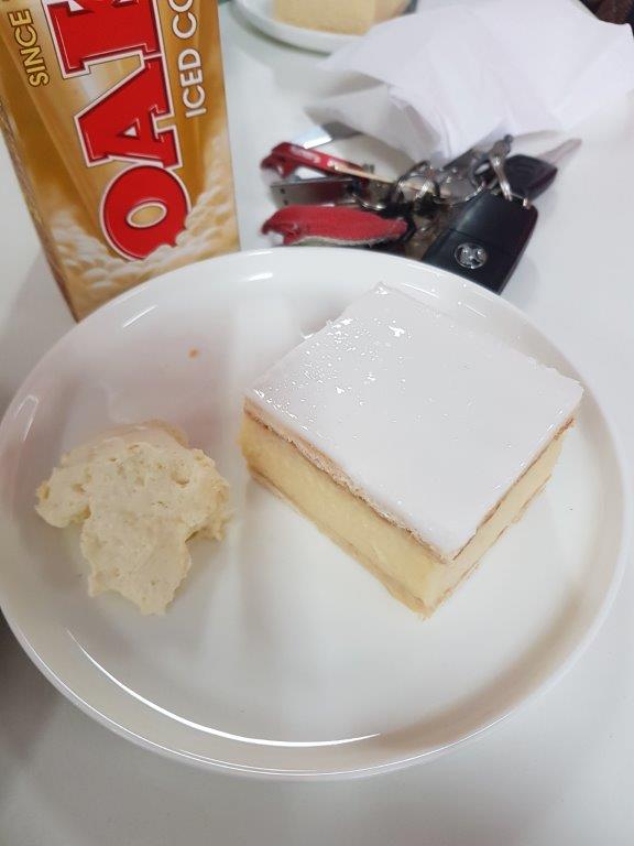
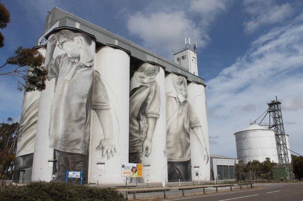
It was a good drive with a stop at Coonalpyn to check out the painted silos then a stop at Bordertown for the Sunshine Bakery. It was after Bordertown that things slowed down. There were a number of roadworks between here and Nhill where they didn’t quite get the traffic control right. Queues of traffic went for kilometres and waits up to 20 minutes to get through was the norm.
Once past Nhill, we were travelling well again. Heading through Horsham, I stopped into Jayco Horsham hoping to get the slide out looked at and maybe fixed but no, most of the staff were off for a long weekend and the only person there was only keeping the lights on as she was having Tuesday off for the Melbourne Cup.
We finally made it to Parkgate Resort at Halls Gap to find a packed caravan park with our group spread out all over the park. We didn’t do our homework there. Apparently, this is a 4 day weekend for Victorians and most book their sites years in advance. At least it will clear out next week.
Glowing in the Dark …
It was a different day today for a couple of reasons. The sky was overcast, the winds had abated and the temperature had dropped 10 degrees from yesterday was the first. The second was we were headed out to stand on the Ground Zero’s of a number of atomic tests from the 1950’s and guaranteed that we would not glow in the dark at the end of the day.
Maralinga was the site of over 700 tests in the 1950’s and 1960’s by the British Government on Australian soil. Seven of these tests were big and even though they left physical damage, the radiation was only minor in comparison. It was the other 700+ tests where they made dirty bombs and blew up anything else they could think of that caused the environmental damage.
A number of cleanups over the years and a lot of money has now rendered the area “safe” which now allows tours to be made of the various sites. The tour guide, Robin, had a radiation meter which we hoped was calibrated right and the area is surveyed each year by ARPANSA to ensure that nothing is leaking from the burial sites.
First stop on the tour is the water retention dam. This dam is fed from the parking area at the airport with the water flowing through a number of drains and aqueducts. The water is then treated before it is deemed safe and drinkable. I still used my own water though.
Onto the Airport with the largest runway in the Southern Hemisphere which is still able to be used as an emergency runway for commercial jets and was an alternative landing site for the space shuttle. Interestingly the water runoff from the runway was never added to the water retention system due to the chance of radioactive material off planes that flew through the bomb clouds getting into the drinking water.
The landing area at each end of the runway is 4m thick concrete with the bitumen for the rest of the runway being 6 inches thick. The runway is still in very good condition for 60 years old and not been touched. It is surveyed every year to ensure that it is still able to be used as an emergency runway.
Off course there was an opportunity to run amok on the runway and we achieved 141kph in the Pajero (I am sure the Colorado could have done better if I had taken it) before running out of the 2.4km runway. There was some interesting bush tucker growing along side the runway in “bush bananas“. Apparently they taste similar to passion fruit.
Even through we are hundreds of miles from anywhere, there is 250 kms of bitumen roads in the Maralinga Zone, still here and in reasonable condition even after all these years. The tour took in 93 kms of these bitumen roads with 2 kms of dirt. The British apparently had a thing for bitumen and concrete. It would have been a good contract back in the day.
It was onto the “Taranaki” bomb site for lunch. This was the biggest of the tests carried out here with a 27 kiloton bomb suspended from a balloon. And here we are eating lunch within a couple of hundred metres of Ground Zero. The area has had $108 million spent on cleaning it up and making it safe or so we have been told. We overlooked 3 burial pits. The first is where they turned the ground into glass using a very expensive and time consuming process. The second pit is where the topsoil of 2.5 square kilometres was buried and the third one is where all the machinery used in the cleanup is buried.
The machinery was driven into the pit, oil drained and the engines run unti they seized. A D11 dozer was then run over them to crush them before covering them over. This will stop anyone thinking about digging them up in the future and using them.
The obligatory photo on the concrete plinth at Ground Zero before heading to the “Breakaway” bomb site. This bomb was let off on the top of a tower and it caused all the sandy top soil turn into glass. We passed a radiation meter over the glass and it was giving off less radiation than being in a modern office. That was good to know.
The final ground zero was the “Marcoo” site which was a bomb that was placed in a cellar which caused a 45 metre crater when it let loose. The crater has been filled in and a lot of machinery including double decker buses was placed in before covering it over. Prior to its remediation, an aboriginal family was found living in it. They were decontaminated and moved onto Yalata. There has been radiation related problems with this family but talking with Robin the tour guide, who is related, the problems were more related to the process of decontamination than the radiation.
There was one more location we visited which was going to be the “Tufi”bomb site but a Treaty was signed with the US and Russia before it was used so it had to be dismantled. It was going to be another tethered balloon and the anchors and concrete to hold the balloon was going to ensure that it would not blow away to Queensland.
The weather had been building through the day with the expectation of thunderstorms during the night. As we were enjoying some beverages over tea reflecting on the days tour, the skies to the south were getting darker and the lightning and thunder were getting more frequent but were still 20-30 kms to our south. This certainly lived up to the meaning of Maralinga being “fields of thunder”.
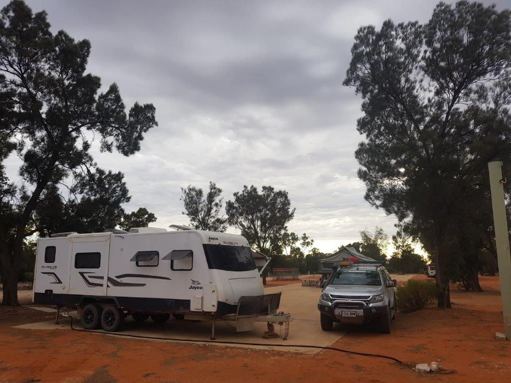
Those that were sleeping in swags decided to move into the shed as the radar showed another line of thunderstorms heading our way. It was probably a good thing as we would find out later in the night. It wasn’t going to worry me too much, being in the Taj.
Some more Darwin exploring …
Today was our last full day in Darwin and with Jenny back home, I could spend it exploring via Geocaching. And that’s just what we did.
We headed northeast of the city doing some 4WDing following tracks and roads that were barely marked on the map. Some of the areas visited looked like they would be perfect spots for crocodiles but none were spotted.
We continued until dark and then called it a day as tomorrow we hit the road again, slowly heading south so that the acclimation to the cold is not too severe.
Left turn Clyde, I said left turn …
Well there were some heavy falls overnight but it had cleared up by morning for another slightly overcast day, well at least in Dubbo.
Travelling east, the things most spotted today were kangaroos sleeping on the side of the road or they could have been road kill. That is something I have not spotted a lot of, live wildlife. There has been plenty of parrots, cockies, galahs and even a wedge tailed eagle (feeding off a sleeping roo) but no large wildlife. I guess that with the amount of feed around due to good rains, they are not near the roads.
Looks like earlier in the year a couple of large fires went through around Dunedoo and Cassilis with a lot of fencing and a few buildings destroyed that I could see. Blazeaid has set up a couple of base camps in the area to assist the farmers in replacing their fences. That may be something to look at when I get round to retiring.
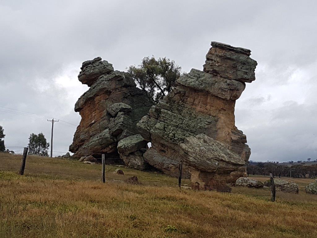
One thing that the fires have done is clear out the vegetation and a lot of rock formations now are visibile from the road whereas previously they would have been obscured. There was one interesting one where it looked like a tree had split a large rock into two columns and there were leaning away on each side of the tree.
There were some heavy downpours as I travelled East but I forgot to take notice of road signs and soon found a lot more reference to Newcastle. I had missed the turn off to Tamworth. Finally there was a road that headed north at Merriwa. It started out OK with a bitumen road passing through farmland then it turned into gravel and dirt with a sign saying that parts may be closed in wet weather. That is great given that I was currently in torrential rainfall.
Stuck it into 4WD and dragged the caravan through creek crossings and slippery clay sections. The van was slowly turning brown from mud but managed to get through OK. Next was a narrow windy section up through the Great Dividing Range. It was bitumen but the face on an approaching car was precious when he came around the corner and saw me with the van in tow. Maybe next time he will drive to the conditions. Did I mention in between the rain it was foggy.
Over the top of the range and back to gravel and mud, this time due to road works. Lucky Jenny wasn’t in the car as her side was a straight drop down with no barriers and the road was a tad slippery. Eventually it was back onto bitumen with enough rain to wash the majority of the mud off the car and van.
Pretty uneventful for the rest of the journey to Tamworth with some more rain, heavy at times. Looks like it is a busy weekend in Tamworth with the Motor Show and a huge Horse Event.
June 12 of 12 …
Once again, another month and on the road again. This time in the Northern Territory. We had a big drive today from Alice Springs through to Mataranka (1075 km).
Camp was broken on daybreak and after a brief stop in Alice Springs getting fuel and supplies. we headed north on the Stuart Highway.
We made a few stops for geocaches but not for me as I had found them all last year. I was travelling with a mate that had never been to the Northern Territory and I had him on rations with some cache finds each hour to break up the drive. It was 800 km between cache finds for me. 🙁
Some of the stops included the Barrow Creek Telegraph Station, Native Gap, Wycliffe Well (the UFO Capital of Australia), Tennant Creek then onto Mataranka.
Unfortunately we didn’t have time to stop at Devils Marbles, but you always need to leave something for next time. 🙂
A few more stops at some memorials and we arrived at Mataranka just on sunset and it was spectacular with the moon and stars appearing as the sun set.
A quick meal at the homestead and then it was into the Thermal Pool for a well deserved 1.5 hour soak. A great finish to the 12th of June.
Down the Coorong …
With Jenny and Rachael on a cruise in the Pacific somewhere, I decided that a road trip was in order and the South East was the spot.
Met up with some fellow Geocachers at Tailem Bend and we headed off to tackle some caches around the Meningie area before hitting the Coorong.
We crossed the Coorong at Tea Tree Crossing which had low water at this time of year. There were a couple of caches near the campsite to be found and going to one, there might have been a momentary loss of traction in the mud 😉 but it was soon remedied by letting down the tyres. 🙂
It was time to head over the dunes and along the beach to a new Earthcache (Wild Dog Island) that we had hoped to find as a “First to Find” but having been unfound for almost 12 months, it was found 2 days ago. 🙁
We were a little behind time but it didn’t stop us finding geocaches further south along the Coorong at 32 Mile Crossing then at Kingston SE, Cape Jaffa, Robe (with a stop for some fish and chips) and finally Millicent before finally getting to Mt Gambier.
Not bad – a journey that should take 4 hours took us 15 hours. 🙂


