Looking at the map, there were a few options to get to the source of the Murray. The first option was just up the road on a track called Cowombat Flat Track. We followed it in and proceeded on a pretty good track for about 4 kilometres but came across a locked gate with no way round. With a 9 kilometre walk in and another 9 kilometres out and the temperature already in the low 30’s we decided to find a different track.
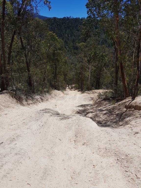
Continuing further west was the Limestone Creek Track with signs showing no trailers and Chris’s map showing some extreme spots. Despite this we went in to see how far we could get. The first bit was steep with some bumpy bits but it improved passing the Limestone Creek camp area which we would come back to for lunch later. There were some more steep sections with the grader ledges to stop erosion but we managed to get in about 9 kilometres before finding the extreme spot. It was steep, there were drop offs and I am sure we would have got down with some banging and scraping but getting back up would have been very difficult particularly as we didnt have a winch between us. This was a good spot to turn back to the Limestone Creek camp area. There was one creek crossing we drove through which showed as Stony Creek on most of the maps but on one map it showed as the Murray River so I guess that is as close as we are going to get to it. Even though it is not the actual Murray, it does feed into it in another 4 kilometres.
Back at Limestone Creek, we found a nice spot next to the creek in the shade with a gentle breeze. All the bumping and banging had taken its toll on Chris and Sues car. We needed to do some bush mechanics on the driver side rear leaf springs but more importantly, almost a whole carton of cider bottles managed to loosen their lids and fill the ice water in the esky with cider.
From the campsite we could spot a rocky outcrop called the Rams Horn. Our last track for the day was a short 5 kilometre return journey on the Rams Horn Track. The track wasn’t too bad with some rocky sections and skinny bits but you could almost do it with a normal car.
We drove until we found a large outcrop with Chris and I making the climb through some bitey bush only to find that the Rams Horn was further on. Back to the cars and continuing on the track we found a carpark at the end and path leading to the top of the Rams Horn. A lot easier than what we had just pushed through. The view were breathtaking and with phone coverage, I was also able to renew the Satellite TV certificate. That should keep the cricket tragics happy.
It was back to camp for a night of cards and cricket with the occasional noise from the brumbies in the bush.


