Its a Long Reach …

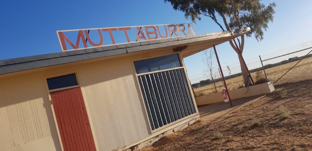
Today was a travel day from Muttaburra to Longreach, a huge distance of 120 kilometres.
 
There was a strong southeasterly wind last night and it persisted through the morning so we held off leaving until 11am. 
Even by then there was still a strong breeze but it was abating just.
 
Just as we were leaving Muttaburra, I got a call from my brother Dale but missed it. I was wondering what had gone wrong at home.
 
Returning his call, it turns out that he had taken my nephew Angus geocaching and was wondering what he is looking for.
 
After sending some photos of the cache he was looking for we continued on our way.
 
Along the way, there was some issues with the van rear camera so we stopped to do some soldering work on the plugs with no luck. There must be another issue.
 
Getting back into service, Dale had send through some photos of the geocaches he and Angus had found in the Belair National Park. I wonder if they are now hooked.
 
Longreach was fairly quiet except at the Longreach Tourist Park where it was starting to fill up. It is a big park with 306 sites and ours was a large bit of ground.
 
It will be our home for the next 5 days.
 
There wasn’t much open today but we filled up the car and did a spot of shopping for supplies.
 
I had another go at getting the caravan rear camera wire fixed but after re-soldering all connections, it looks like the wire may have an issue.
 
Hopefully I can get some more wire at the hardware store tomorrow.


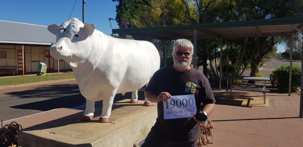
Another Geocaching Milestone – 19000 finds …

After a sleep-in, we finished off the geocaches around Muttaburra including a mini power trail along Broadwater which is a section of the Landsborough Channel available for camping but there were not too many camping.
 
Many of the caches in the area have been hidden by RoddyC and youngoldfella in readiness for a major Geocaching event to be held in September. I will be coming back for that event.
 
It just happened that they were in the next town called Aramac (about 85 kilometres away), placing more caches for the event.
 
After a couple of phone calls, we organised to catch up in the afternoon.
 
It was getting close to the 19000 milestone so after checking out which cache it would be, we headed to Aramac.
As it turned out, White Bull (GC72TC3), in the centre of Aramac was the lucky cache and was also the spot we caught up with Rod and John.
 
It was good to catch up and chat about the September event.
 
After clearing the geocaching map around Aramac, it was back to Muttaburra, dodging the dead kangaroos, live kangaroos, live emus, live cattle and live horses.
 
At one point I stopped to see if my eyes were deceiving me. There were three rogue cotton bushes growing on the edge of the road complete with cotton ready to pick.
 
Tomorrow we head to Longreach for 5 days of tourist activities.
 

Where the bloody hell is Muttaburra …

The next couple of days is all about geocaching and trying to get close to my next milestone of 19000 finds. To do that around here, the only place nearby with a lot of caches is Muttaburra.
 
But where the bloody hell is Muttaburra. Well it is around 100 kilometres north of Longreach in Central Queensland.
In fact the geographical centre of Queensland is just out of Muttaburra.
 
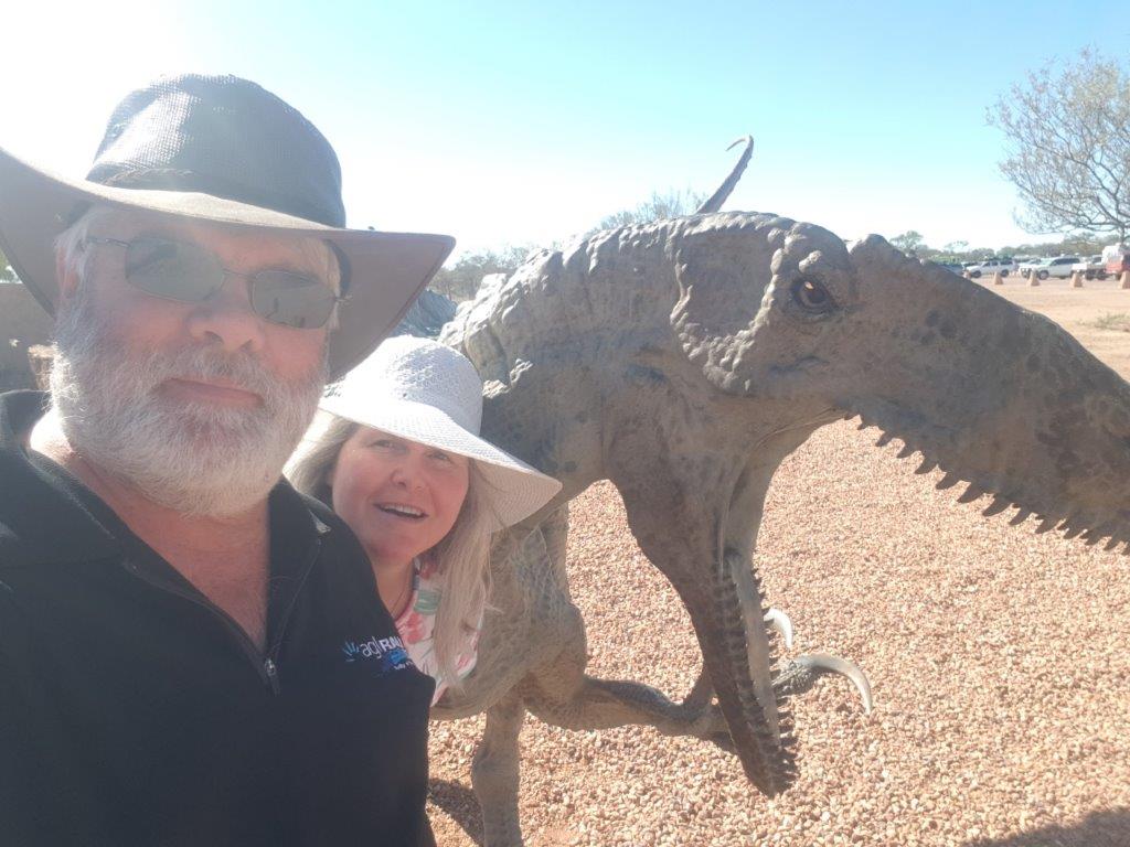
The town has a population of around 76 and its claim to fame is Muttaburrasaurus Langdoni which is a dinosaur of which fossils have been found nearby.
 
We took the Morella Muttaburra Road from the main highway which was a 80 kilometre black earth track with concrete floodways interspersed along it. 
 
The road was very smooth but also very soft if you moved off the main wheel tracks. I am sure this would not be passable with any sort of water on it.
 
The road then turned into a gravel road and then bitumen for the last 10 kilometres.
 
The local council has set up a caravan park with very reasonable rates of $15 a night for a powered site but after 2 nights it is free. I guess they are trying to get people to stay here.
 
Once the van was set up, we headed out to grab geocaches as well as discover what is around the place.
For a small town, there is plenty to see.
 
On nearly every corner is some sort of sculpture, either made from barbed wire or things found in farm sheds. The favourite was the shearer and sheep made from farm bits.
 
A close second was the Cessna aircraft at the entrance to the airport.
 
It was amazing the amount of kangaroos around town. No need for lawnmowers here as you have your own kangaroos to keep the grass well kept.
 
Muttaburra was also one of the 60 camp sites for the 1891 Shearer Strike.


Is this Jurassic Park …

Today was all about dinosaurs especially since Winton is the dinosaur capital of Australia.
 
The region around Winton, Richmond and Hughenden has unearthed a lot of dinosaur fossils in the blacksoil. 
 
There has been that many fossils found, the Australian Age of Dinosaurs Museum and Laboratory is now located just out of Winton.
 
The Ultimate Experience ticket we purchased gave us 3 tours, the collection room, the laboratory and Dinosaur Canyon.
 
The three main dinosaurs in this area are Australovenator wintonensis (Banjo), Diamantinasaurus maltidae (Matilda) and Savannasaurus elliottorum (Wade).
 
It was a good 4 hours learning and looking. We would recommend it to anyone interested in dinosaurs.
 
Winton has the Royal Open Air Theatre in the main street. It has been here for 100 years and this week just happens to be the “Vision Splendid” Film Festival so we took in a movie.
 
Last time we did an outdoor theatre was in Broome a couple of years ago.
 
The movie tonight was “The Butterfly Tree” an Australian film which was listed as a comedy, family drama. Not sure about the comedy or family but was definitely drama.


Yippee ki yay …

Once again, we opened the blinds this morning and the campground was empty. That’s OK we only are moving onto the next town, Winton, 150 kilometres away.
 
The land was fairly flat with a lot of floodway up and downs.
 
We were 10 kilometres out from Winton when it was a total standstill due to clogging traffic but not what you think.
 
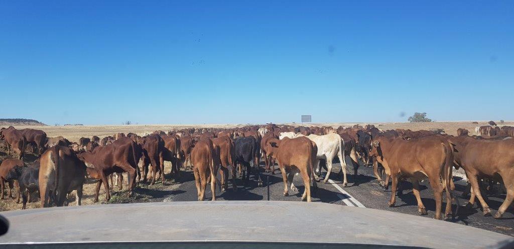
The area has been in drought for around 7 years and there was a large herd of cattle being driven along the stock route which is also the highway.
 
The cattle were just been gently moved along, eating the grass along the way.
 
It took about 15 minutes to get through the herd at walking pace. We were nearly through when the young steers mad a run and got around in front of us again.
 
Arriving into Winton, I tried the first 2 caravan parks and they had no vacancies unless we had a booking so it was off to the final one before we looked for free camps.
 
The Matilda Country Tourist Park didn’t take bookings so it was your place in line determined whether you had a site or not. We were lucky to get one of the last few sites.
 
Once set up, it was time to have a look around town (it is not that big) and the area.
 
First stop was the original landing field for Qantas although there is nothing there now apart from a musical fence and a commemorative rock.
 
Next it was down to the original location of Winton at Pelican Waterhole. Even though the site was up on high ground, apparently it flooded out so the town was moved to even higher ground.
 
It was then time to drive the “Route of the Gums”, a self drive tour through Bladensburg National Park. It used to be a cattle property but is now a National Park.
 
At the old homestead, there was a lot of information about the former life of the property. The drive took in  a number of waterholes and a couple of spots with some intriguing history.
 
The 1891 Shearer’s Strike Memorial was at the location of the Camp of 500 striking shearers which was the beginning of the foundation of the Australian Labour Party.
 
At Skull Hole back in 1888, 200 aboriginals were massacred in retaliation of the murder of a station cook.
Most of the camping areas in the Park were packed with free campers.
 
Our van was sited next to Banjo’s Barn in the caravan park so we had country music while we had dinner and then we went round to listen to a bush poet, Gregory North.
 
It was a good show with some modern twists on some of the classic bush poetry of Banjo Paterson.
 

Thats not a knife …

We had planned to make a small journey of 110 kilometres from Cloncurry to McKinlay and stay at the Walkabout Creek Hotel.
 
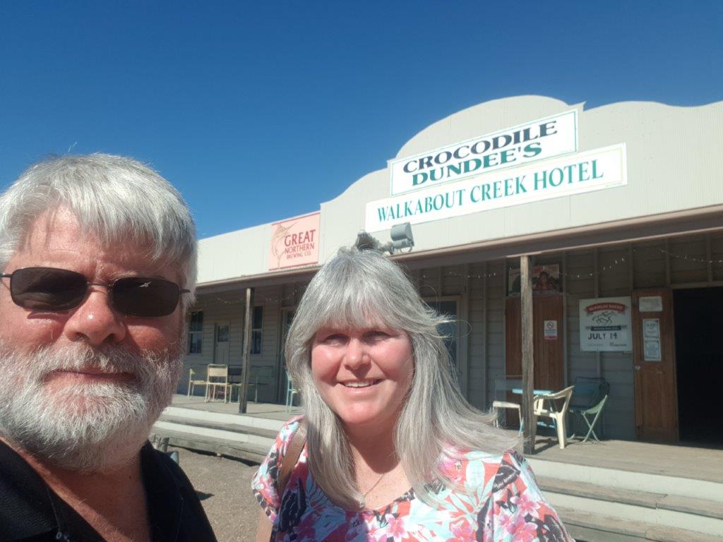
We arrived fairly early in McKinlay and visited the Walkabout Creek Hotel which was the hotel they filmed Crocodile Dundee.
 
There was a bit of film memorabilia but not enough to keep us here for the night so we continued on to Kynuna down the track.
 
I think the Kynuna township had a population of 16, but there was at least double that camped in the Kynuna Roadhouse Campground.
 
We spent the afternoon chatting with a couple, Gavin and Margaret, travelling from Griffith, NSW.
 

It’s a Pretty Blue but don’t be swimming in it …

We only had 120 kilometres to travel from Mt Isa to Cloncurry but it took 4 hours. And it wasn’t because of geocaching – well not entirely.
 
Half way between the two towns is the old site of the Mary Kathleen Uranium Mine, which operated from 1954 to 1984.
 
Even though there are no buildings left on the site, you can go up to the old open cut pit to see the vivid blue water but not sure you would want to go for a swim in there.
 
Back at the old town site, the bitumen roads and concrete gutters are still there as is all the concrete pads where all the houses and shops used to sit.
 
It was surreal given that we had watched the film from the 60’s showing life in the town. You could pick where the old town square was and the beer garden. The bowling club was also recognisable.
 
It is not all that abandoned with it now a highly recommended free camp with many caravans, motorhomes and tents utilising the old house pads.
 
Along the way we stopped at the Clem Walton Reserve or Corella Dam which was built to supply water to the Mary Kathleen Uranium Mine. We thought it sounded like a good spot to either have lunch or free camp but about 200 other vans had the same idea. It was a great spot but if we are going to be packed in like a caravan park, we might as well stay in one closer to town.
 
Arriving at the Cloncurry Caravan Park Oasis, there was a bit of a queue but luckily they have an overflow area. 
I am not sure we are in the overflow though as we were directed to a site near the entrance and ablution block.
 
We spent the afternoon exploring the town including the Mary Kathleen Memorial Park where some of the buildings from the mine have been moved to live a new life.
 
To the north of town, at the airport is one of the original Qantas hangers. Its has been restored and there are some information panels to read on the outside. The other original hanger is in Longreach.
 
From the airport we headed to the Chinamans Creek Dam which provides water to the town as well as the mines that are in the area. 
 
There was a lookout that gave views over town and afar. We waited around for sunset but as there were no clouds to speak of, it wasn’t all that spectacular.
 

Lets go mining …

A pinch and a punch for the first day of the month. OK, I know a bit corny but hey I am a dad.
 
Sunday is pancake day at the Sunset Top Park, so Jenny headed out to grab a pancake and she came back with a plate full.
 
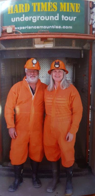
The plan for the day was to head underground at the Hard Times Underground Mine Tour
 
With the Mt Isa Mine no longer doing mine tours, this purpose built tourist mine has taken over.
 
It was constructed to the same design and standards as the normal mine with all the equipment being retired gear from the main mine.
 
The tour guides are all retired miners and ours was Steve.
 
Before heading down, you get to dress up with bright orange paper overalls, an orange hard hat and light and gum boots. We looked like road cones on steroids.
 
After the obligatory shot at the elevator (to sell to us later) we descended down in the elevator to the mine tunnel.
 
Even though it is only 15 metres down, you could have been at any depth as there is no noise from above.
 
It was dark, warm with high humidity similar to a normal mine but apparently the real deal is a lot hotter.
 
Steve took us through the history of Mt Isa mining with the different decades of machinery and techniques.
 
We learnt how to blow a face then got the chance to do some drilling.
 
There was even a front end loader that he fired up and moved around for us. It is extremely loud in the confined tunnels as are all the other machinery demonstrated.
 
The tour finished with a meal in the crib room underground and plenty of stories of Steves times in the mines and the pranks that were carried out.
 
We were taken back to the surface on the back of a Toyota carrier. The tour had lasted 3 hours.
 
It was well worth going on this tour and would recommend it to anyone travelling to Mt Isa.
 
It was time to spend some time above ground and we headed out to Lake Moondarra to have a look and grab some geocaches.
 
Lake Moondarra is the water supply to Mt Isa and the Mine built by the Mine. 
 
As well as providing water, it is a place to go fishing, water skiing, canoeing, 4WDing and of course geocaching.
 
There was plenty of bird life particularly on the 4WD track following the edge of the lake back to town.
 
Tomorrow we continue our travels east.
 

Hello Queensland …

It was windy all night and it didn’t let up this morning so we were in no hurry to get on the road.
 
To keep the fuel economy good, there was no speeding until a couple of road trains passed then I hooked on the back and got pulled along.
 
There were a couple of stops along the way to look for things and after a couple of hours we arrived in Mt Isa.
 
There was no way you didn’t know where it was. The copper smelter was firing on all cylinders and the black smoke was pumping out of the stack.
 
Luckily the wind was blowing away from town as there was only a little creek separating the mine from the town.
 
After settling the van into the Sunset Top Park, Jenny was dropped off at the shops to get here fix while I discovered the town through geocaching.
 
After picking up Jenny we checked out the town from the highest point at the lookout. From here you can see most of the surrounding landscape.
 
For the last couple of years there has been an ad for the Buffs Club on the satellite TV, so tonight we had to check it out for a meal.
 
It wasn’t a bad meal and was obviously the most popular place in town.
 
After our time at the Buffs Club, it was back up to the lookout to check out the view at night. The mine was certainly lit up and the full moon didn’t disguise the smoke from the copper smelter.
 

Farewell to NT …

We hadn’t even gone to sleep when we got a call from the US. It was just after midnight and apparently it is Rachael’s 21st birthday here in Oz so she gave us a call.
 
I am sure we celebrated it a month ago. Oh well, happy 21st again Rachael.
 
When we woke up and looked outside there was an empty campground with us the only one in the park.
 
After filling up with almost our most expensive fuel ($1.899), it was onto the road to Queensland.
 
I had read that the Barkly Highway was a rough ride but the road yesterday was some of the best we had been on and it started out the same today.
 
As soon as we hit the floodplains though the road became a roller coaster ride. The soil must be reactive here with the water in the wet season and lots of ups and downs and bumps.
 
It certainly showed today why it was called the Tablelands. The lands for as far as you could see was as flat as a table.
This is cattle country and there was plenty of cattle today and even some horses to see.
 
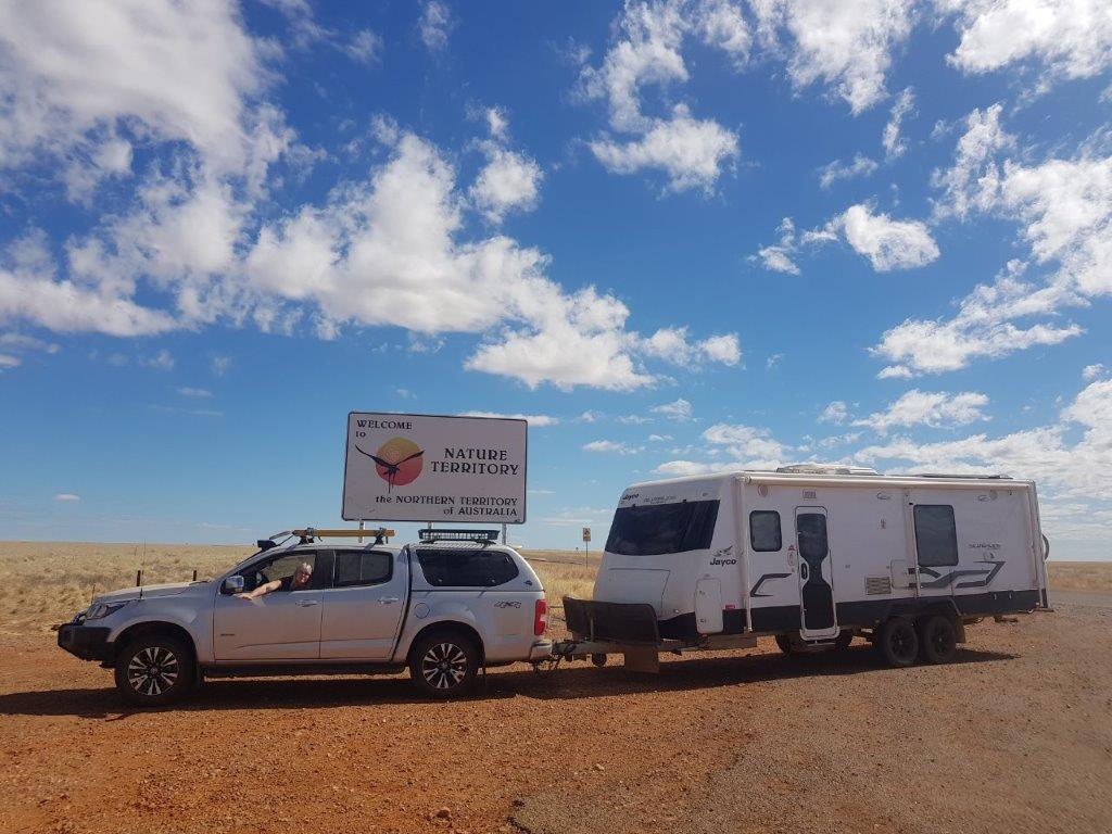
We farewelled Northern Territory and welcomed Queensland with the obligatory Border photos.
 
Today’s camp was Camooweal with its drover history. Not much here except for a couple of servo’s, a pub and a couple of caravan parks.
 
After setting up camp, we headed down to Camooweal Caves National Park to have a look. It seemed to be a claytons National Park with cattle roaming all over the place.
 
These caves are similar to the Nullarbor Plain but are not open to have a look. All you can see are a couple of sinkhole cave entrances.
 
Before heading to the van we checked out Lake Francis free camp on the western side of town. It was packed with vans lining the banks for about a kilometre.
 
You might as well be in a caravan park being that crammed in.
 

Follow the Life and Times of the Thompson Family ….